At the northern limit of the Civitas Ammaiensis, on the left bank of the Tagus river, remains of a historic gold mining site are preserved. The modern name of the site, Conhal, refers to an ancient gold extraction of either Roman or Moorish period. Clear traces of human interference and similarities with well-known Roman gold mines in the northwestern Iberian peninsula were unveiled (doctoral research S. Deprez, Ghent University).
In order to understand this extremely disturbed landscape, a profound geologic and geomorphologic study of the site was performed. Via field survey and an analysis of the river sediments, in combination with aerial photography, an ideal basis was created for the understanding of the gold mining site. The main research topics so far included the determination of the genesis, the composition and the age of the gold-bearing sediments, as well as the gold extraction itself. The numerous stone heaps or muria, composed of quartzite cobbles and boulders, indicate the use of the arrugia extraction technique. This technique is based on the relative density of gold. The larger cobbles were removed by hand, while the remaining river sediment was washed away leaving only the heavier gold particles. Consequently, the gold extraction required large quantities of water.
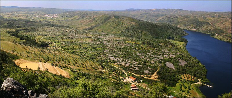 Overview of the gold mining site of the Conhal (photograph by D. Taelman)
Other important features that are related to the arrugia extraction technique and that are clearly visible in the Conhal landscape are the water evacuation channels, the remains of large water storage basins and the presence of aqueducts for the water provisioning of the mining activities.


