• Home
  • Events
    • LAC 2014, Rome
    • Mérida/CIAC 2013
    • Perth/CAA 2013
    • People Conference – November 2012
    • Limassol/Lemesos Conference – October 2012
    • Seville Congress – June 2012
    • Book launch
    • Leuven Symposium, 2012
    • Berlin – Conference, June 2012
    • Frankfurt Conference, March 2012
    • Southampton Conference, March 2012
    • Brussels Innovation Convention, December 2011
    • Vienna Conference, November 2011
    • Copenhagen Conference, September 2011
  • Training
    • Summer School
    • 3rd Specialization Forum
      • Report on the 3rd Specialization Forum
    • 1st MAC Workshop of Archaeological Geophysics
    • Aerial Archaeology Training School
    • 2nd Specialization Forum
    • 1st Specialization Forum
    • Posts
  • Radio-Past
    • Project details
    • Research techniques
      • Airborne remote sensing
        • Traditional aerial imaging
        • Helikites and drones
        • NUV and NIR photography
        • LiDAR
      • Field survey
      • Geophysical survey
        • Earth resistance
        • Georadar
        • Magnetometer
        • Susceptibility
      • Topographical and geomorphological survey
        • Geomorphology
      • Groundtruthing
      • Virtual reconstruction
    • Partners
    • Reference projects
  • Publications
    • Booklet + dvd
    • Ammaia I
    • Ghent Colloquium
  • Open Lab Ammaia
    • Recent activities
      • 2010 Campaign
      • Book launch / Lisbon
    • Job opportunities
    • History
    • Recent research
      • Aerial survey
        • Aerial photography
        • LiDAR
      • Surface artefact collection
      • Geo-archaeological survey
        • Gold mining
        • Stone quarries
        • Rural landscape
      • Geophysical survey
        • Earth resistance
        • Georadar
        • Magnetometer
        • Magnetic susceptibility
      • Topographical survey
        • Reference system
        • Digital elevation model
      • Field survey
      • Architectural scanning
      • Excavation
        • Trial trenching
        • Thermae excavations
      • Material studies
        • Artefact study
        • Laboratory analyses
      • Virtual reconstruction
    • Mapping the city
    • Archaeological park and museum
    • Bibliography
  • Multimedia
    • 3D-reconstructions
      • Renderings
      • Reconstructions
    • Maps and plans
    • Movies
      • EAIE Conference
      • RTP Report 2
    • Panoramic images
    • Photographs
      • Snow in Ammaia!
  • Links
  • Site map
  • Contact
  • Login
Browse: Home / Radio-Past / Research techniques / Geophysical survey / Earth resistance

Earth resistance

Earth resistance survey is one of a number of different geophysical survey techniques that can be applied by archaeologists to record the remains of sub?surface archaeological structures. It is based on the ability of sub?surface materials to conduct an electrical charge passed through them. All materials will allow an electric current (i.e. the flowing of charged particles) to a greater or lesser extent. The technique is based on the creation of an electric current between probes in the earth to measure variations in resistance over a survey area.
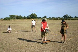
Electric resistivityResistance is measured in ohms (?), whereas resistivity, the resistance in a given volume of earth, is measured in ohm?metres (?/m). Resistivity survey, has since many decades been very successful in archaeology, especially for locating walls, ditches, paved areas and banks, and the application of resistance tomography allows such features to be recorded at various depths.

Search

News


3rd International Landscape Archaeology Conference


A Romano-Lusitanian townscape revealed

Copyright © 2016 Radio-Past.

Powered by WordPress and Hybrid. Operated by 7reasons