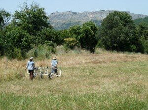
Magnetic survey in the southern suburbs of Ammaia
Spatial deviations of the natural magnetic field can be registered with the help of geomagnetic measurements. These deviations occur due to magnetic embeddings in the top soil which affect the magnetic field characteristics locally. The natural magnetic field is a three dimensional vector field measured in Tesla [T ] (SI unit describing magnetic field strength). It is composed of the actual Earth’s magnetic field (ca. 50.000 nT), distortions caused by solar storms and a local anomaly field (up to several 100 nT). When it comes to industrial and archaeological prospection the latter is the component of main interest. Geomagnetic prospection is often the most effective survey method for non-destructive investigation of archaeological sites. Herein two techniques can be used to obtain the data of interest. Either the field components are separated during the measurement using orientated gradiometers, or the total field is measured and the components are separated in subsequent data processing.

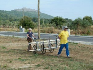
Magnetic survey along the streets of Sao Salvador de Aramenha
Magnetic anomalies of archaeological features result from induced or remanent magnetism. Induced magnetism is caused by the Earth’s magnetic field and is very much dependent on the susceptibility of the material. The suscepti-bility describes the degree of magnetization of a material in response to an applied magnetic field and can be either positive or negative. Magnetic anomalies of pits, ditches and postholes for instance are often detectable through positive induced magnetisation of a few nT. Remanent magnetisations have various causes, a well known one being thermoremanent magnetisa-tion. This occurs when ferromagnetic materials are heated above the Curie-Point and cool down again, causing the magnetic moments to partially align within magnetic domains. Thus, fireplaces, burnt clay, fired ceramics and bricks can easily be detected on account of their special magnetic characteristics.

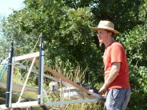
Starting another magnetic profile
High quality magnetic maps for archaeological prospection need high resolution. Therefore dense measure grids are chosen in the field. Data points are collected every few cm in the direction of the profile, the sensor separation being 50 cm. With the help of multi-sensor cart systems several sensors (usually up to 10 ) can be carried at a time. Individual whee suspensions allow the cart system to be operated even over complex and rough terrain. In this way, non-destructive magnetic investigations of large areas can be completed in reasonable times. Between 2 and 10 ha per day can be surveyed depending on terrain conditions (steepness, soil, vegetation especially trees, modern obstacles etc.). Furthermore these systems are set up with real-time GPS-positioning and special hardware and software that makes it possible to visualize and interpret the magnetic data whilst still in the field.

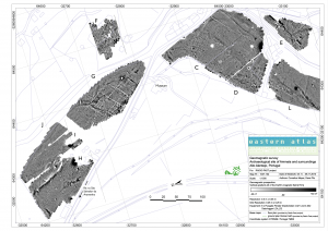
South-eastern section of the magnetic map of the extramural area
Please click here to see an enlarged image of this map


